Stereo Radargrammetry Using Deep Learning-Based Image Matching with Fine-Tuned Model on Synthetic Aperture Radar Images
Koichi Ito (Tohoku University), Tatsuya Sasayama (Tohoku University), Shintaro Ito (Tohoku University), Haruki Iwasa (Tohoku University), Takafumi Aoki (Tohoku University), Jyunpei Uemoto (National Institute of Information and Communications Technology)
Remote Sensing, vol. 18, no. 10, pp. 1662-1--1662-21, May 2026.
Abstract
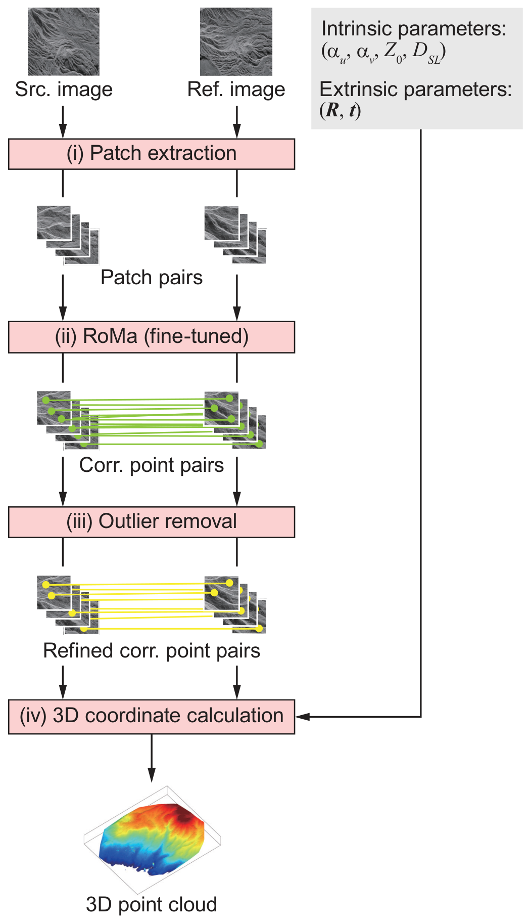
Stereo radargrammetry using Synthetic Aperture Radar (SAR) images is a powerful technique for all-weather 3D topographic measurements. However, conventional methods based on local template matching often struggle to establish accurate correspondences in mountainous or vegetated areas due to severe SAR-specific geometric modulations. In this paper, we propose a novel high-accuracy stereo radargrammetry framework by introducing RoMa, a robust Transformer-based deep learning model, for dense SAR image matching. Optical pre-trained deep learning models often suffer from a domain gap. To overcome this limitation, we develop an automated pipeline to construct a patch-based SAR image dataset using a reference Digital Surface Model (DSM) and an SAR projection model. By fine-tuning RoMa on this dataset, the model effectively adapts to the complex non-linear deformations of SAR images. Furthermore, unlike conventional methods, our approach establishes correspondences directly on the original slant-range images without requiring ground-range projection, thereby avoiding image quality degradation caused by pixel interpolation. Experimental results using airborne Pi-SAR2 images demonstrate that the fine-tuned RoMa significantly outperforms conventional methods, achieving an 82.86% matching accuracy at a 10-pixel threshold. In the 3D measurement evaluation, the proposed method achieves the lowest elevation mean error (-1.24 m) and the highest inlier ratio (74.1%), proving its effectiveness in generating accurate, dense, and wide-area 3D point clouds even in challenging terrains.