Research/ Remote Sensing
Introduction
Remote sensing observes the Earth's surface from a distance using aircraft, satellites, and other platforms. Radar is employed to measure the surface with high precision from afar. Here we describe our research on surface analysis using synthetic aperture radar (SAR).
Synthetic Aperture Radar
Aerial photographs captured by cameras are also used in remote sensing, but radar offers characteristics especially useful for remote observation. Whereas cameras can acquire images only during daylight, radar can image regardless of day or night.
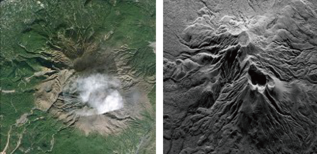
Figure 1: Image captured by a camera (left) and by synthetic aperture radar (right)
Pi-SAR2
Pi-SAR2 is an airborne synthetic aperture radar developed by the National Institute of Information and Communications Technology (NICT). As shown in Figure 2, it is mounted beneath the wing of an aircraft. Our laboratory analyzes SAR images acquired by Pi-SAR2 in collaboration with NICT.
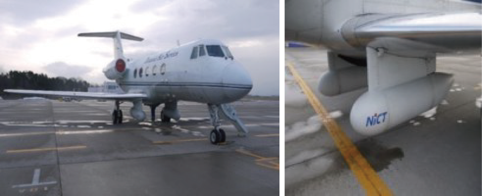
Figure 2: Airborne synthetic aperture radar Pi-SAR2 developed by NICT
3D Measurement
Given SAR images acquired along multiple flight paths, stereo vision can be used to measure the three-dimensional shape of the surface. For methodological details, see references [1] and [2].
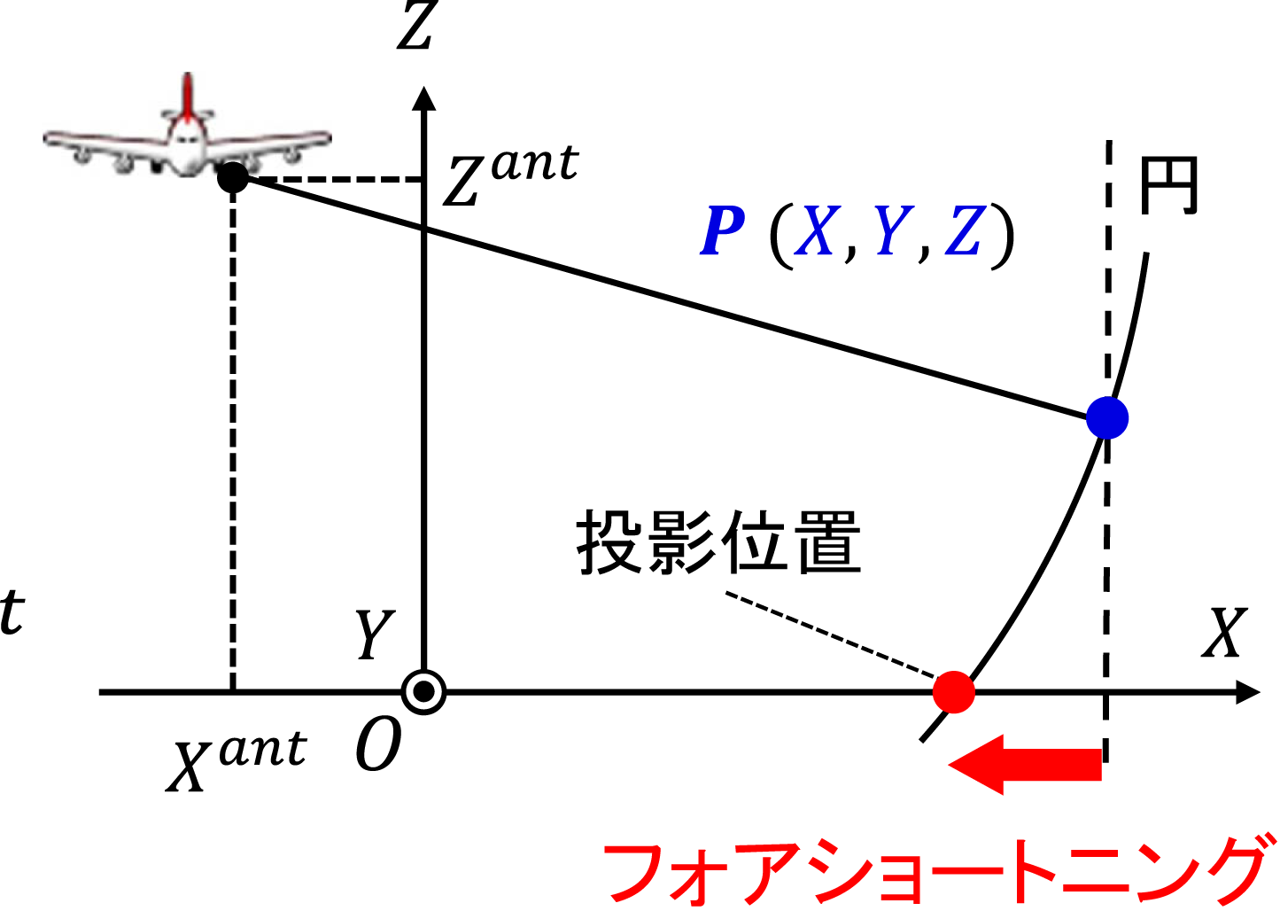
Figure 3: Projection model of SAR images
Fault Observation
Another example is fault observation. If displacement between SAR images acquired at different times can be measured with high accuracy, fault offsets caused by earthquakes can be quantified. For methodological details, see reference [3].
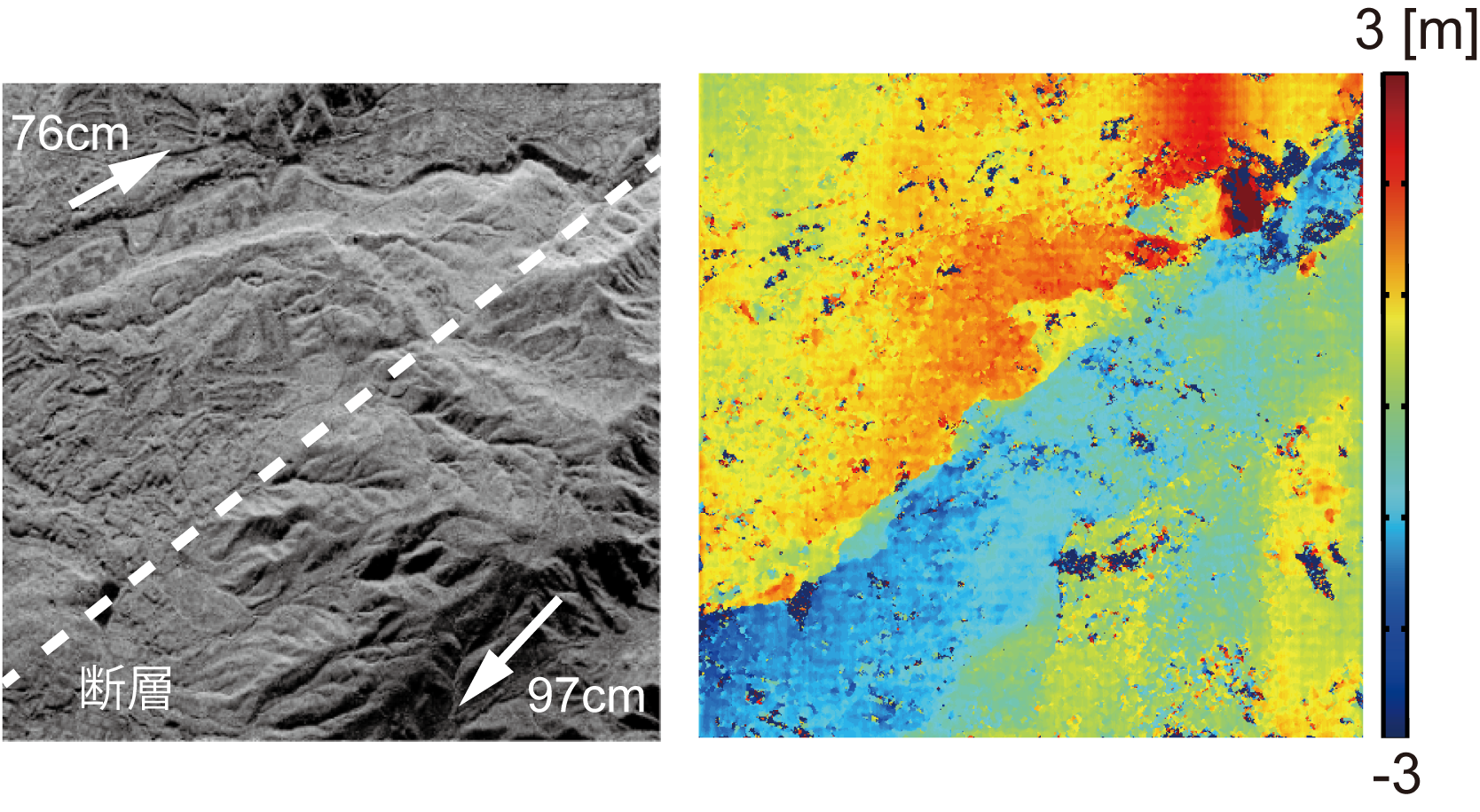
Figure 5: Detection of fault offset caused by the Kumamoto earthquake (left: SAR image, right: detection result)
Summary
We have introduced remote sensing research in our laboratory using radar imagery. This work represents a new endeavor that fuses computer vision techniques with conventional remote sensing technology.
References
- D. Maruki et al., "Stereo radargrammetry using airborne SAR images without GCP," Proc. IEEE Int'l Conf. Image Processing, no. COI-P2.5, pp. 1-5, September 2015.
- K. Insfran et al., "Accurate 3D measurement from two SAR images without prior knowledge of scene," Proc. IEEE Int'l Geoscience and Remote Sensing Symp., pp. 4814-4817, July 2021.
- H. Imai et al., "A method for observing seismic ground deformation from airborne SAR images," Proc. IEEE Int'l Geoscience and Remote Sensing Symp., pp. 1506-1509, July 2019.